MAJULI, ASSAM, INDIA: A GEO-ENVIRONMENTAL ANALYSIS
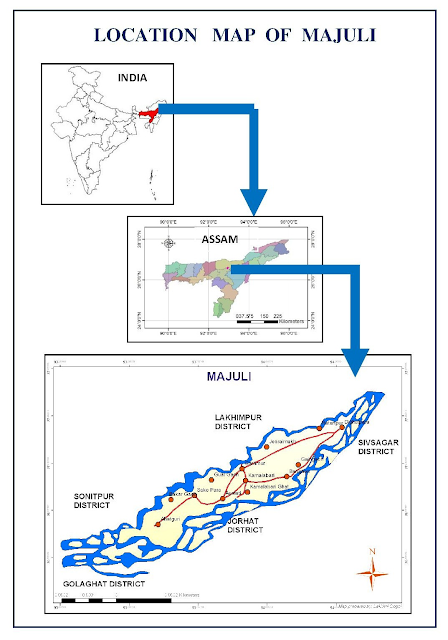
The island of Majuli is situated at the bosom of three river systems, i.e, Subansiri, Kherakhutia suti and the main Brahmaputra . Majuli forms the part of the floodplains of Brahmaputra river, thereby continuously facing serious problems of bank line erosion which has posed a threat to its rich cultural heritage and its existence as well. The severity of the problem can be quite specifically be depicted in case of the Majuli island, the largest inhabited riverine island of the world. Previous works from various geomorphologists reveal that the rate of bank erosion has been increasing at an alarming rate. Therefore, the present study attempts to investigate the state of river bank erosion and few necessary measure needed to be implemented for the recovery from this threat be coupled with improvement of rice production in the region, thus to reduce food insecurity within inhabiting population. ...